To contextualise the scenarios and the findings in this study, background information relevant to the study sites is described below.
There are three study sites: 1) A military hospital site in Accra that is associated with large roosts for fruit bats, 2) Ve-Golokuati, the capital of the Afadjato District in the Volta Region, and 3) Tano Sacred Grove in Tanoboase, near Techiman.
In Ve-Golokuati (population 14,000) most people are farmers, growing vegetable crops. Tano Sacred Grove is a small farming community with a population of 5,500. The majority are engaged in smallholder agriculture with traditional system of farming and livestock keeping.
Apart from the increasing hunting pressure In Tanoboase, the conversion of land into farms and plantations for fruits and cashew is expanding as the majority of the farmers are depending on the land for sustenance. This is increasing the conflict between bats and farmers.
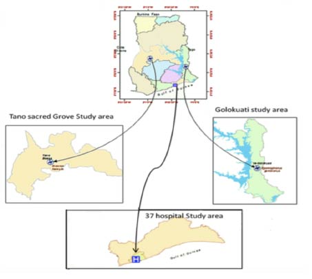
Figure: Map of study site in Ghana.
Ijara District and Tana River, both located in an arid/semi-arid area in north-eastern Kenya.
In Ijara District pastoralism is the main source of livelihood. In Tana cultivation is the main activity, sustained with irrigated farming. Both areas are inhabited by vulnerable communities whose livelihoods are highly susceptible to climate variability and infectious diseases.
Ijara District is undergoing gradual land-cover changes, largely driven by climate change and demographic shifts relating to people, livestock and wildlife.
The area around Tana River has experienced rapid land-use/land-cover changes over the past 20 years or so, due to the establishment of large-scale and smallholder irrigation schemes, introduced to alleviate food insecurity.
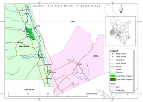
Figure: Map of the study site in Kenya showing the major land uses and ecosystems.
The study sites are four communities in the Kenema District with recorded Lassa incidence: Majihun, Lambayama, Lalehun Kovoma, and Largo Squire in Segbwema. At the Kenema Government Hospital, 500-1000 suspected cases of Lassa fever are seen each year. The region receives much higher rainfall than other parts of the country and accounts for most of the forested areas. Each of the sites displays potentially important variants of ecosystem and land-use features, and the ecological and climatic conditions that might favour outbreaks of the Masotomys rodent.
All the communities studied are engaged in farming rice, cassava and other staple crops. Lambayama and Largo Squire are more urban and Majihun and Lalehun Kovoma are rural, also engaged in mining activities.
Land use changes are seen by converging natural ecosystems to agriculture, urban expansion, and settlement. These may be increasing contact and transmission from rodents carrying pathogens, with possible significant impacts in poor farming, peri-urban and mining settlements.
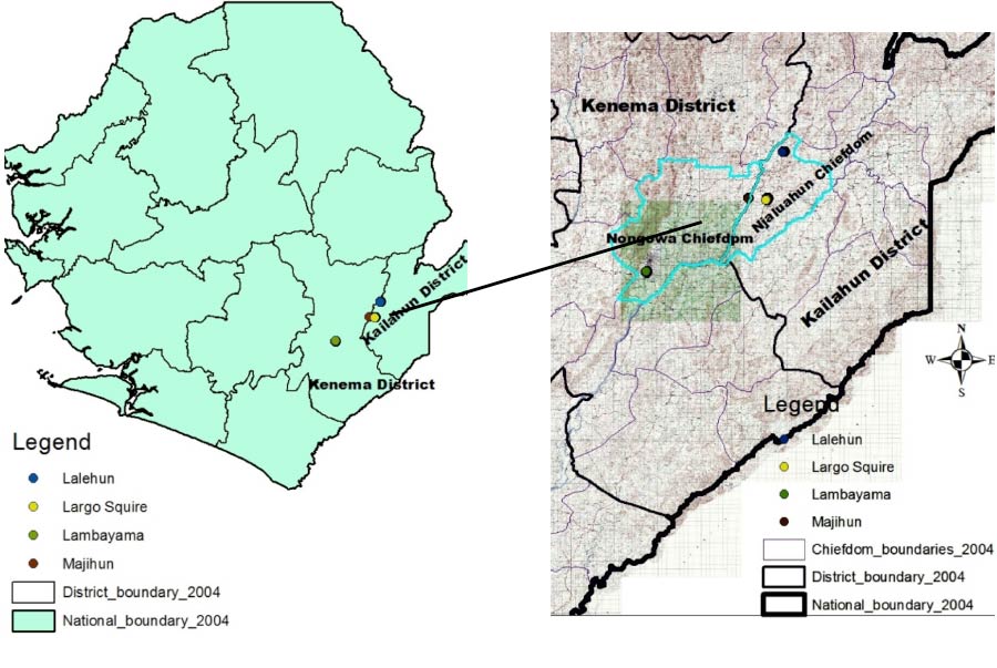
Figure: Map of the Kanema District and the 4 communities.
Southern part of the Luangwa Valley, located in the Eastern Province of Zambia.
Farming is the main livelihood strategy, with maize and groundnuts commonly grown for home use. However, cash crops are on the increase.
Mambwe District is undergoing gradual land-cover changes, largely driven by climate change and demographic shifts relating to people, livestock and wildlife.
Since the decline of the mining industry, cotton growing has been promoted, resulting in increased land clearance. Livestock population density on the plateau has also been increasing. Other notable changes include increasing food production on mountain slopes. This is the result of a shortage of arable land, particularly around large towns. It has caused deforestation, soil erosion and flooding. Many people are moving into the area in search of fertile land for farming.
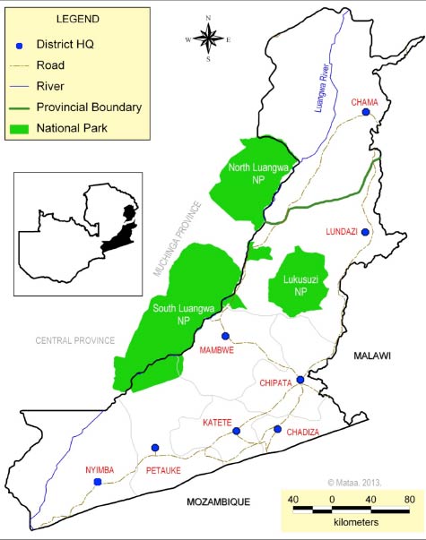
Figure: Map showing Mambwe District and the National Parks in Eastern Province of Zambia.
Hurungwe District is in the Mashonaland West Province, in the Northern part of Zimbabwe and overlapping the Zambezi Valley. This is one of the most populous districts in Zimbabwe, with a population of 324 675. It is prone to drought, floods, poor soils and, occasionally, marauding animals, all which harm or destroy crop fields during summer. Disease outbreaks are common.
Threatened by poverty, the people of Hurungwe are engaged in four distinct activities for livelihood: 1) Foraging, 2) Livestock production 3) Hunting, or 4) Farming.
Over the years people have migrated and settled in these regions increasing the pressure on both land and ecosystems. Development processes and land use change in the region has over time have resulted in poverty among residents, leading to devised strategies for livelihood, such as intensification of agriculture and cultivation of cash crops. These strategies have in turn impacted the regional ecosystem services, biodiversity loss, and changed wildlife habitat.
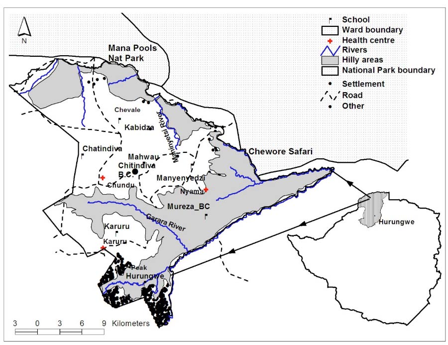
Figure: Mukwichi Communal Lands, Hurungwe District.